This wayfinding system was developed for the Health and Life Sciences Building (H&LS) at the University of Reading to enhance clarity and ease of movement. It addresses real navigation challenges, including ambiguous entry points, repetitive floor layouts, and a lack of visual cues.
For the full brand manual, click here.
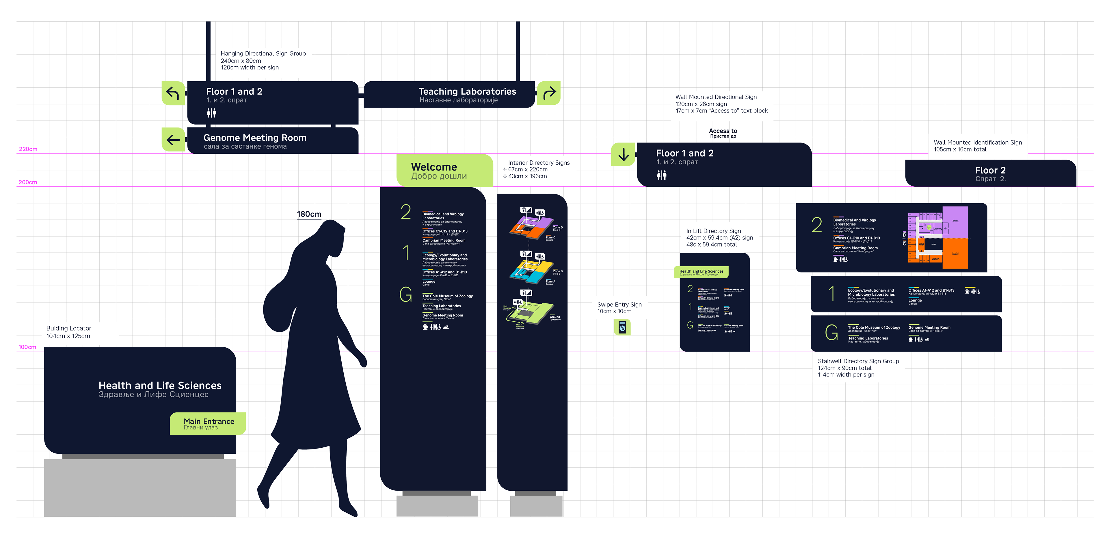
Wireframe of all signs in the wayfinding system (part 1)
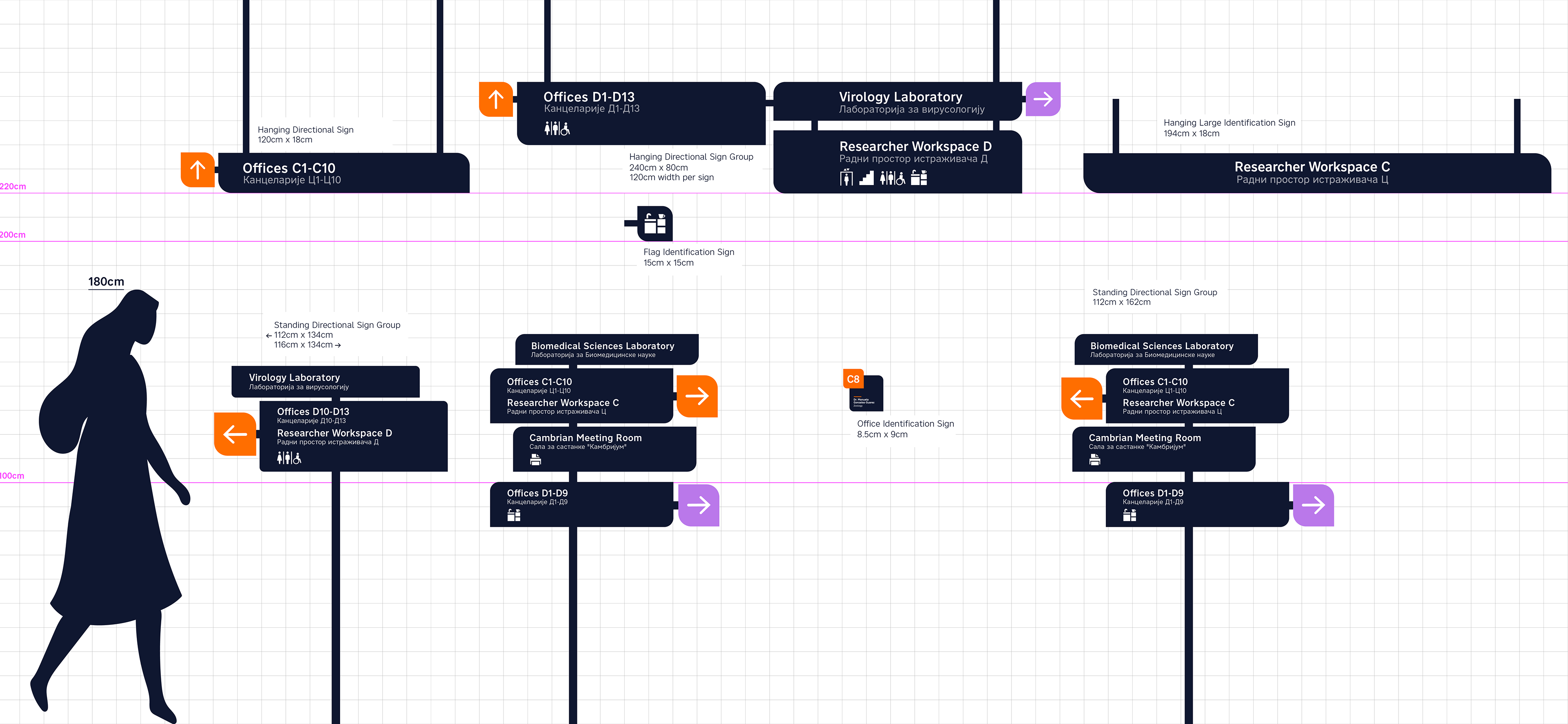
Wireframe of all signs in the wayfinding system (part 2)
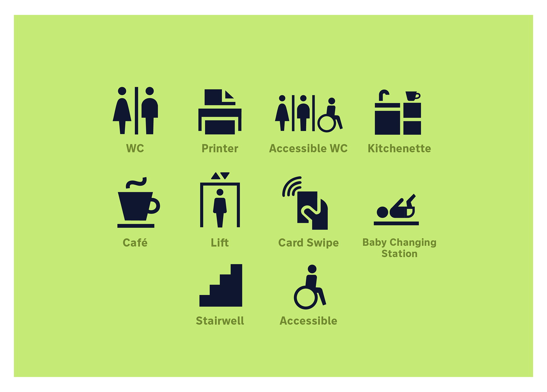
Custom icons that are primarily used on flag identification signs or as the final line of information on directional signs. Their design reflects the bold, minimal aesthetic consistent with other elements of the wayfinding system.

The H&LS arrows for directional signage always appear within the leaf shape when displayed on all signage whether it be hanging or standing signs.
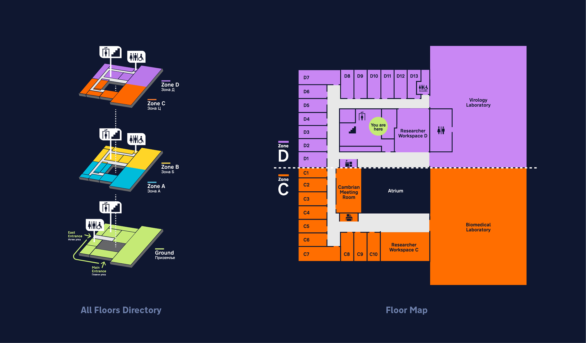
(Left) Simplified multi-floor map that is displayed on monolith carriers. The stacked view helps the user to quickly understand the general layout of the building. (Right) This is an example of the more complex maps that exist in the stairwell of each floor. This design details all of the rooms and facilities of a given floor in addition to their zone.
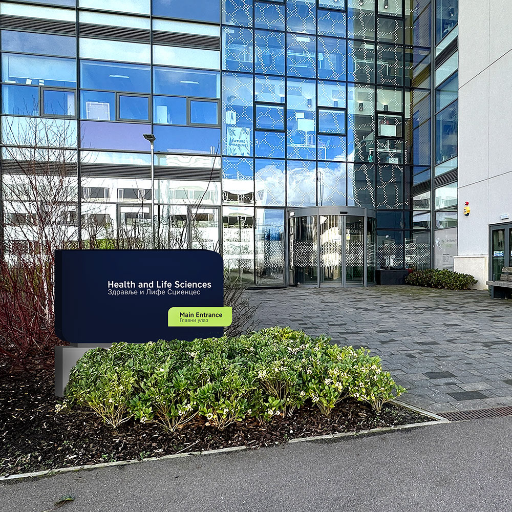
Exterior to the H&LS building marked with a building locator sign.
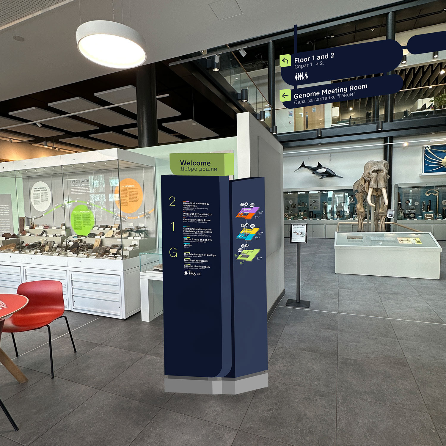
Main entrance of the H&LS building marked with a monolith to orient visitors as well as hanging directional signage to guide visitors to destinations on the ground floor.
The design process began with site observations and participant interviews to understand how users navigated the space. Spatial patterns and visitor flow were mapped to identify decision points and signage needs. Prototypes were developed and tested for legibility, floor-level recognition, and multilingual clarity. The visual system was refined through iterative feedback, focusing on modular forms, consistent color use, and integration with the building’s materials and layout.

Print of signage at full scale placed in the area in which it would be mounted to test legibility.

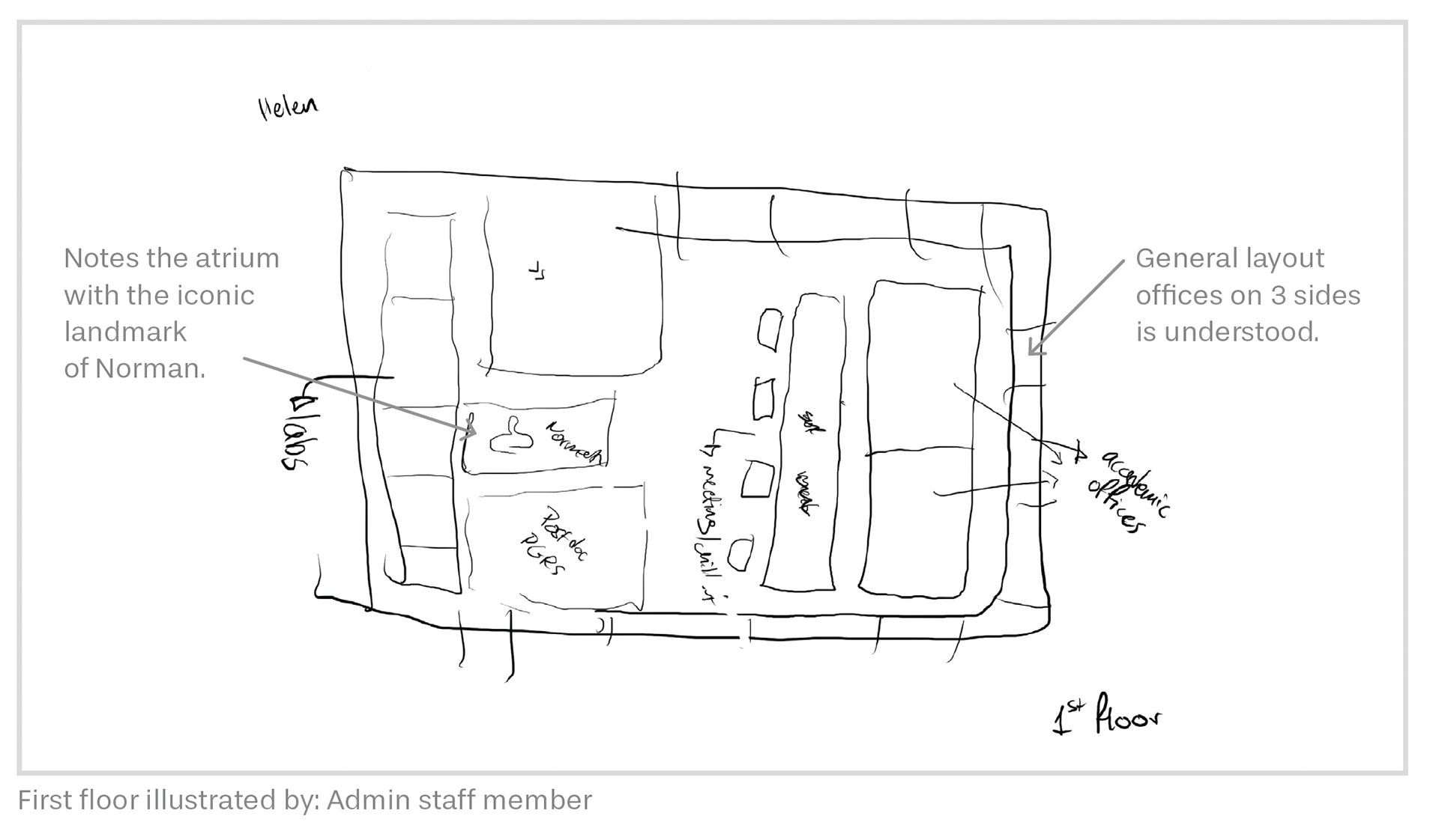
Initial sketch of the first floor of the H&LS building determining sign placement from main decision points.

Initial sketches of sign system determining typographic hierarchy and division of space.
Mental map from building participant and my annotations of findings.
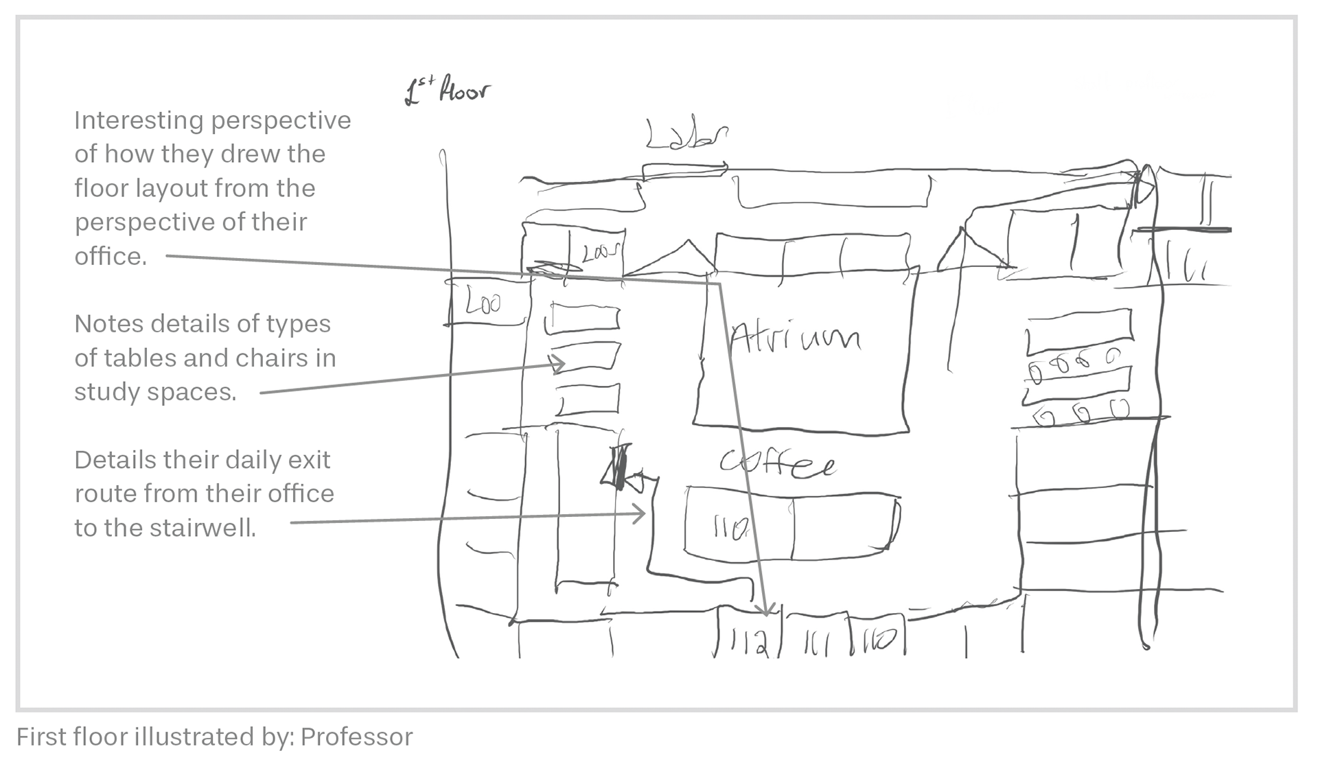
Mental map from building participant and my annotations of findings.
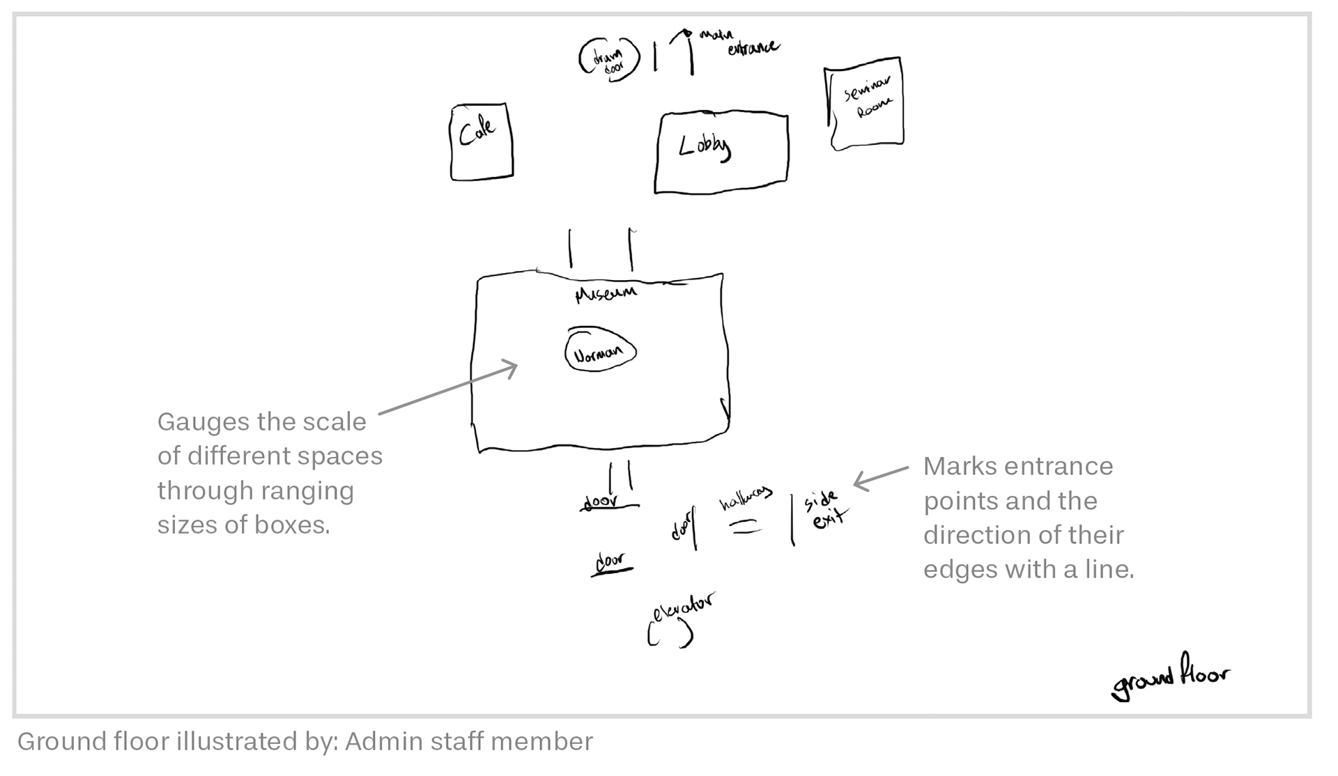
Mental map from building participant and my annotations of findings.
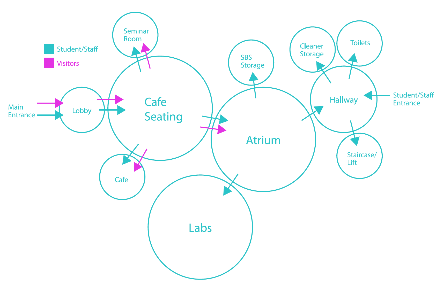
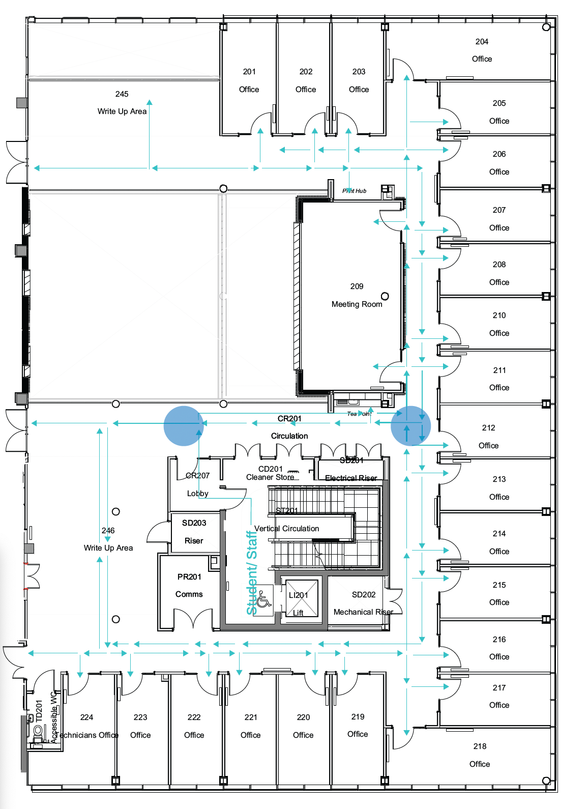
Communication diagram of the ground floor of the H&LS visualises how people move through the space and which areas occupy the most traffic.
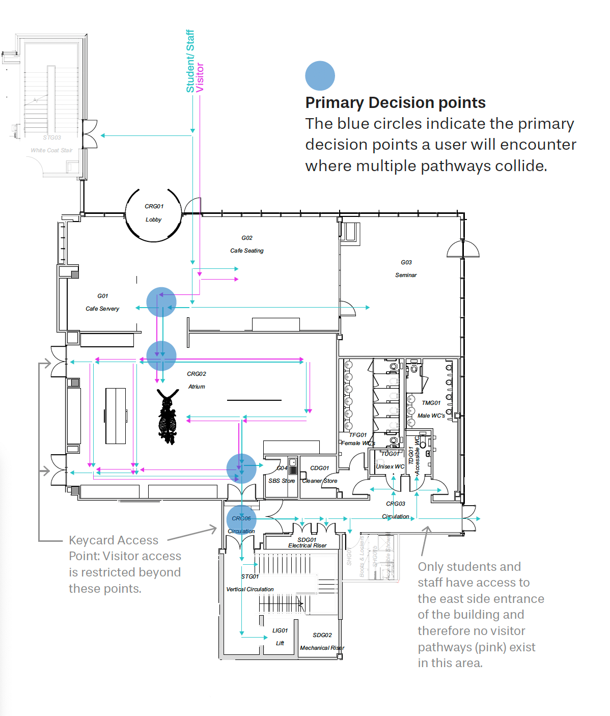
Ground floor visitor flow that maps out all the possible directions a person can take in the building.
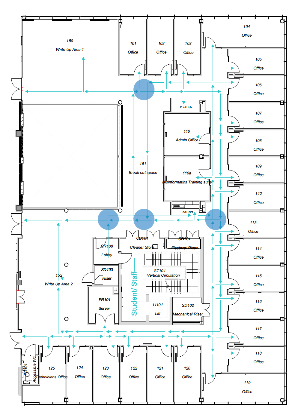
First floor visitor flow that maps out all the possible directions a person can take in the building.